
 Day Trips
around Lagos
Day Trips
around Lagos
A Brief History -- What
to Do -- Where to Stay -- What to Buy
Lagos Scenes -- A Visit to
the Algarve 1572 -- Other Places -- Map
-- Home
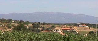
| The two mountains to the north of Portimăo are
known as the Serra de Monchique. The higher of the two is Foia, and the other Picota. They
are the remnants of Jurassic volcanoes. The Rocha Negra - Black Rock - of Praia da Luz is an intrusion of the lava from those volcanos. |
 |
The village of Monchique lies on the slopes of Foia, and around here there are several
restaurants offering Chicken Piri-piri, a grilled or barbecued chicken marinated in a hot
pepper sauce.
Below the village are the Caldas de Monchique, the mineral water springs utilised since
Roman times. A Bishop built a Hospital here, for the benefit of those wishing to take the
waters. King Joăo II came here, in 1495, in the hope that the treatment could alleviate
his illness. Nowadays Monchique water is bottled and sold.
On the top of Foia are the radio and television masts which serve the Algarve, and from
here it is said that you can see Lisbon, if the weather is fine. Like all mountains,
however, these attract clouds, mist and haze and it would be an exceptional day to see
that far. If it is, in anyway, fine, magnificent views stretch away to the south and the
sea.
Silves, to the east of Monchique, lies on the River
Arade, which flows down to the sea at Portimăo. In earlier times the river was navigable
up to this point by fairly large vessels. Today there are trips there in the traditional
Portuguese 'canoes' which depart from Portimăo.
Crowning the hill overlooking the river is the Castle of Silves, which was the Alhambra of
the Al-Gharb. The knights of the re-conquest, under King Sancho I, attacked and took the
castle in 1189. The Moors shortly regained possession of their capital and despite
numerous assaults the city held out until 1266, when Dom Paio Peres Correia conquered this
last outpost of Arab rule in the Algarve.
Just inside the city walls is an archaeological museum, set up around the Moorish Town
well.
The Cathedral of Silves is on the road from here, back down to the river.
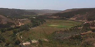
The town of Aljezur lies on the Lagos to Lisbon road. From here a road may be taken cross-country to Marmelete and the Serra de Monchique.
 |
 |
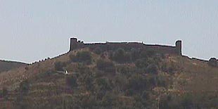
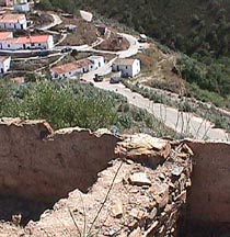
| Aljezur 'Castle' | View towards the coast |
The most striking feature is the castle set on top of the hill overlooking the town. This
is, in fact, not a castle with keep and bailey and quarters for soldiers, but the original
fortified town. Recent archaeological excavations have found that the Moors first
constructed it in the late 8th Century. When the Christians conquered the Algarve, Aljezur
nearly held out until the fall of Silves.
In the 14th Century, new houses were constructed in the castle on top of the
Moorish foundations, keeping to the basic layout, but now butting directly onto the walls
covering the Arabic walkway which had previously lain around the inner circumference.
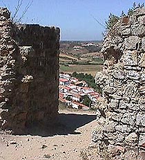 |
 |
Aljezur from the castle gate |
A 13th century house wall |
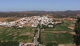
Gradually the town spread out of its bounding walls and down the hill. The second part of
the town, constructed on the other side of the river, owes its location to a Bishop, who
considered that the West bank was unhealthy.
 |
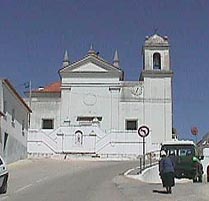 |
| The 'new' town | Aljezur Church |
 |
A good day out, especially for the young and active, is a visit to a Waterslide Park, of which there are three west of Faro in the Algarve. This is the nearest. |
Top of Page -- Map -- Home